
Friday 17th September
Our accommodation gets a 7/10, losing points for poor TV reception and being so far from the walk.
Today is the big one for us as we are doing 20 miles over
very hilly terrain, time will tell how we manage but we feel quite confident
when we set off. As the accommodation is so far from the walk, the lady gives us
directions to rejoin the walk without having to retrace our steps, it does not
put any greater distance onto the walk thankfully but does include an initial
very steep climb which the Canadians seem to manage very easily, surprising,
as they say they have not done long distance walking before. As we get
onto Urra Moor, there is nothing but heather as far as the eye can see, I would
have thought it quite possible to get lost if you did not follow the waymarked
tracks. We arrive at Bloworth Crossing, where the Canadians now a dot
on the horizon follow the line of the old railway, as we turn northwards
towards Burton Howe at 1419 feet, then Tidy Brown Hill with views over
Battersby. We can still see the Bilsdale TV transmitter mast where we started
our day. Downhill at last into Kildale where we have an ice cream at the Post
Office and then go on to the Café where we get our passport stamped again.
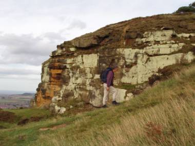
At Captain Cooks Monument with Roseberry Topping in the
distance and the North Sea just coming into view.
A cup of tea gives us much needed strength to climb up to Captain Cook’s Monument, at 1064 feet it gives an incredible view over Great Ayton and toward Roseberry Topping where we take another wrong turning. We had decided not to climb Roseberry Topping but to continue to Newton Moor, as there were no waymarked signs we finished up at the foot of Roseberry having descended a very steep hill, at the foot of Roseberry we realised our mistake and had to retrace our steps and climb back up the hill adding a further 1 mile to our journey, but it was 1 mile of steep decent and ascent!
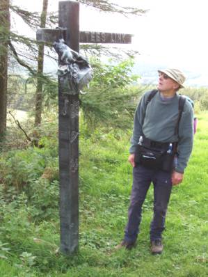 On
entering Guisborough Woods we see a sculpture of a signpost with a haversack
hanging from it, all made in what appears to be lead, the sign reads TEES LINK,
although we did not know it at the time it transpires that The Tees Link is a
17km trail which connects the Cleveland Way at Highcliff Nab to The Teesdale Way
at Middlesbrough Dock. The Tees Link accommodates long distance walkers as part
of the E2 European route from Harwich to Stranraer. Now that IS some walk.
On
entering Guisborough Woods we see a sculpture of a signpost with a haversack
hanging from it, all made in what appears to be lead, the sign reads TEES LINK,
although we did not know it at the time it transpires that The Tees Link is a
17km trail which connects the Cleveland Way at Highcliff Nab to The Teesdale Way
at Middlesbrough Dock. The Tees Link accommodates long distance walkers as part
of the E2 European route from Harwich to Stranraer. Now that IS some walk.
It is the Ryder Cup golf on Ceefax and the radio so we follow the success of the first days play intently both before and after dinner. The restaurant was superb, with a carvery including the biggest turkey I have ever seen, so I had a few slices of turkey, Brian had the roast beef and that should give us strength for tomorrows long walk.